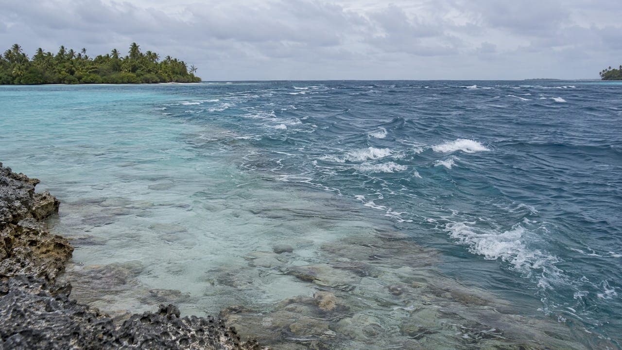
Currents in French Polynesia are real, local and only partly predictable from a tide table. The strongest flows run through the narrow passes of the Tuamotu atolls, where a lagoon fills and empties through a few gaps in the reef. In the Society Islands, lagoons are larger and calmer, but passes and rip currents still deserve respect. French Polynesia sits in the south of the Pacific Ocean and spreads across five archipelagos, so the answer to "how strong are the currents?" depends on where you are, what the swell is doing and when you go in the water.
This guide explains what drives the flow, where it is strongest, and what it means for divers, swimmers and anyone traveling by yacht.
TL;DR
- Tides here are semi-diurnal, but wind, swell and rain-fed lagoon outflow often override the tide table, so timing a pass is never a pure calculation.
- The Tuamotu passes carry the fastest water: incoming flow at Rangiroa's Tiputa Pass can reach six knots, and Ahe's modeled pass currents reach 2 meters per second.
- Divers dive with the current, carry a surface marker buoy and stay close to the guide. Local dive centers time pass dives precisely.
- In the Society Islands, lagoons are gentler, yet rip currents occur and most beaches have no lifeguards.
- A crewed yacht with a captain who reads passes daily is the most comfortable way to meet these conditions.
Table of Contents
- Why tides alone do not explain the currents
- The Tuamotus: where the flow is strongest
- The Society Islands: lagoons, passes and rip currents
- What currents mean for divers
- What currents mean for swimmers and snorkelers
- What currents mean for the boat
- Our perspective
- Planning a crewed charter around the currents
- How to prepare before you go
- FAQ
- Sources
Why tides alone do not explain the currents
Tides in French Polynesia are generally semi-diurnal: two highs and two lows a day. The tidal range, however, varies a good deal between archipelagos, and it is small compared with what many travelers know from the Atlantic or the Pacific coast of North America. That is the first surprise. A modest tide does not mean a gentle current.
What fills and empties a lagoon is a combination of forces:
- Swell and waves. A study of Moorea found tides to be comparatively weak, and showed that episodic offshore waves largely drove circulation over the reef, through the lagoon and out the pass. Waves breaking on the outer reef push water into the lagoon, and that water has only one way out.
- Wind. Cruising guidance for the Tuamotus explains that wind-driven water piled over low reefs can produce outgoing pass currents regardless of the nominal tide.
- Rain and river output. On high islands, runoff after heavy rain adds to what the lagoon must discharge, one of the factors that makes pass-current timing and direction hard to predict.
- A very high sea. At islands ringed by barrier reefs and cut by passes, large amounts of ocean water enter the lagoons when the sea is running high, and the passes become rivers.
So can you predict currents from the tides? Partly. The tide tells you when the ocean wants to move water in or out. The swell and the wind tell you whether the lagoon agrees. The same guidance recommends watching the water directly and checking with local dive clubs, advice we would echo for any visitor.
Slack water is not always where the table says
Slack water is often the calmest window when wind and swell are light. During swell events, though, slack tide and slack current may not coincide, so a lagoon can keep pouring out of a pass long after the tide has officially turned. A swell can add an outgoing current of 1 to 6 knots on its own, and combined with an outflowing tide the total can reach 8 to 10 knots, according to the same Tuamotu sailing account. Those figures describe extreme combinations rather than a typical day, but they explain why local knowledge matters so much.

The Tuamotus: where the flow is strongest
An atoll is a ring of reef with a lagoon inside. Water that enters over the reef or through a pass has to leave through the same few gaps, and a small gap with a large lagoon behind it makes a powerful channel. The result is some of the most dramatic diving in the Pacific: sharks, rays, dolphins and clear water, all riding the current.
Rangiroa and Tiputa Pass
Rangiroa is one of the best-known diving atolls in French Polynesia. The Pacific Coral Reef Foundation reports that incoming currents at Tiputa Pass can reach six knots, and that shark locations vary with the state of the current and the direction of the tide. In practice, that means the dive is planned around the water: the guide chooses an entry point and time that let the current carry the group along the wall while the marine life gathers where the flow concentrates food.
Fakarava: Garuae and Tumakohua
Fakarava's North Pass, Garuae, is a favorite with divers who want a drift through a wide channel. A Fakarava guide notes that Garuae dives are normally entered on an incoming tide from the ocean side, so the current carries divers into the lagoon, and that local dive centers time the dives precisely. The Divers Alert Network (DAN) adds that on Fakarava the incoming tide brings clear water and more sharks.
At the southern end, Tumakohua Pass behaves differently in detail but follows the same logic. The Important Shark and Ray Areas fact sheet reports that incoming and outgoing currents shift approximately every six hours, and that updraft locations change when the tide reverses. The pass is not a single experience: it changes with the hour, and so does the wildlife.

A small tide, a big current: Ahe
The numbers from Ahe Atoll show the principle clearly. A peer-reviewed study found an average tidal amplitude below 30 centimeters, yet its model produced pass currents reaching 2 meters per second. That is roughly four knots from a tide that would barely wet your ankles on a beach. Small tide, powerful pass.
The Society Islands: lagoons, passes and rip currents
Tahiti, Moorea, Huahine, Raiatea, Tahaa and Bora Bora are high volcanic islands with large lagoons and barrier reefs. Because the lagoons are bigger relative to their passes, flow is usually gentler than in the Tuamotus, and sheltered snorkeling spots and ray-feeding areas are easy to enjoy. Bora Bora's lagoon is large and has several passes and channels, so the strength of the current changes noticeably from one corner to another.
The Moorea research gives a useful picture of what happens: waves break on the outer reef, water spills across into the lagoon and drains out through the passes. When the swell is up, expect more flow in and out of the pass, and more movement over the shallow reef flat. On calm days, much of the lagoon is still.
Two local cautions apply. Canada's official travel advice says that tidal changes can cause powerful currents and common rip currents in French Polynesia, and that beaches generally lack lifeguard supervision. The same advice recommends consulting residents and tour operators about hazards and safe swimming areas, and following warnings from local authorities.
If you are choosing between the two island groups for a first trip, our guides on Society Islands or Tuamotus and the best Society Islands by yacht charter explain how conditions and scenery differ.
What currents mean for divers
Pass diving is the signature experience of the Tuamotus, and it is also where currents matter most. A few principles come up again and again in the guidance we have read.
- Dive with the current, not against it. DAN's 2025 report on Fakarava recommends diving with the current rather than fighting it.
- Let the dive center set the timing. Because the useful window can be short and the direction can shift, local operators time pass dives precisely, as noted for Garuae above. Leave the clock to them.
- Stay close to your guide. DAN warns that Garuae's currents can pull divers into the blue and that downcurrents can carry them over the reef edge. Its briefing advice was to stay close to a diver carrying a safety sausage.
- Carry your own surface marker buoy. For Fakarava, DAN advises bringing a surface marker buoy on every dive, as well as staying close to the person who carries one.
- Match the site to your experience. Some sites are sheltered. One Tahiti and Moorea dive report describes a site open to all levels, with a mild tidal current at shallow depth, while the big pass dives suit more experienced divers. Ask your dive center which category a site falls into on the day, since conditions change with swell.
If you hold an open water certification only, say so at the briefing. A good dive operation will place you on a dive that suits your training and the day's water.
What currents mean for swimmers and snorkelers
Most visitors will never enter a pass, but everyone gets in the water. Sensible habits go a long way:
- Ask your host, captain or tour operator where the current runs and where safe swimming areas are, as the Canadian advice suggests, before you wade in from a beach or a dock.
- Stay inside the calm part of the lagoon, away from the channel mouth, and do not swim toward a pass.
- If you feel a rip current pulling you away from shore, do not fight it head-on. Swim parallel to the beach until you are free, then angle back. Most beaches have no lifeguard, so tell someone on the boat or ashore where you are going.
- Wear reef shoes. The Canadian advice recommends them to reduce injuries from coral and stonefish, which matters most when you are wading near moving water.
- Snorkel with a flotation vest if you are not a strong swimmer, and keep children within arm's reach near any channel.
The point is not to avoid the water. The lagoons of French Polynesia are among the most inviting places on earth to swim; you simply ask first, and let the day's conditions guide your plans.
What currents mean for the boat
From the helm, a pass is a navigation decision. The Tuamotu sailing guidance points out that when wind opposes current, the water throws up confused standing waves, which makes weather and swell as important as the tide table for boat handling. A pass that looks calm from shore at one hour can be steep and short at another.
This is why many charter itineraries in the Tuamotus are built around passage windows: arriving in daylight, entering near slack water when conditions allow, and holding off outside when the swell says wait. It is also why the experience of the people on the bridge counts for more here than almost anywhere else. Our own team is made up of former captains and water sports professionals, and the first thing we look at when shaping a Tuamotu route is how the passes will fit the days of the week, not just the distance between anchorages.
Our perspective
We have spent our careers on the water, and the lesson that stays with us in French Polynesia is that the current is part of the destination rather than an obstacle to it.
The Tuamotu passes are the reason divers come: the grey sharks, the dolphins riding the bow wave of the incoming tide, the clear water streaming into the lagoon. None of it happens by accident. It happens because someone read the swell, the wind and the moon, and chose the hour.
That is why we plan crewed charters rather than simply listing boats. A private yacht gives you the one thing a fixed timetable cannot: the freedom to wait a day for better water, to move to a calmer anchorage when the swell builds, and to dive a pass when the conditions are at their best. We would suggest matching the route to the season, the swell outlook and your own comfort in the water, and letting an experienced crew handle the rest.
For first-timers, we often start in the Society Islands, where the lagoons are forgiving and the scenery is dramatic, then add the Tuamotus for those who want the full wildlife encounter.
Mo
Planning a crewed charter around the currents
If you are weighing a yacht charter in French Polynesia, ask how the route handles the passes, how the crew treats swell, and what the plan is for divers of different levels. We build custom itineraries on sailing yachts, motor yachts, catamarans and larger vessels, with former captains and water sports professionals guiding the planning. You can start with our French Polynesia yacht charters page, compare routes in our itineraries, or speak to a yacht charter specialist about the right mix of islands and atolls for your group.
If the question is Society Islands against Tuamotus, our comparison of which crewed charter route suits you sets out the trade-offs in plain terms.
How to prepare before you go
- Choose your season with the crew. Swell patterns change through the year, so talk to your charter specialist about what conditions to expect for your dates.
- Tell us your experience level. Certified divers, snorkelers and non-swimmers all enjoy these waters, but on different parts of the itinerary.
- Pack the right kit. Reef shoes, a personal surface marker buoy if you dive, and a rash guard for lagoon days.
- Build in flexibility. The best pass days are the ones where the water cooperates. A spare day in the plan makes it easy to wait for it.
- Follow local advice. Residents, captains and dive centers know the passes. Follow their guidance and any local-authority warnings.
FAQ
Can currents in French Polynesia be predicted by the tides?
Only in part. The tides are semi-diurnal, but wind, swell and rain runoff influence how a lagoon fills and empties, so pass currents can run against the table. Local dive centers and captains watch the water as well as the tide.
Where are the strongest currents in French Polynesia?
In the Tuamotu passes. Incoming flow at Rangiroa's Tiputa Pass can reach six knots, and a modeled study of Ahe Atoll found pass currents of up to 2 meters per second despite a tidal range under 30 centimeters.
Is it safe to swim and snorkel with the currents?
Yes, with local advice. Official travel guidance notes powerful tidal currents and rip currents, and few lifeguarded beaches. Ask your host or operator where it is safe, stay away from pass mouths, and wear reef shoes.
Do I need to be an advanced diver for the Tuamotu passes?
The big pass dives suit experienced divers, but many sites in the Society Islands and lagoons are milder. Tell your dive center your certification and experience, and they will match you to a suitable dive for the day's conditions.
What ocean is French Polynesia in?
French Polynesia is in the south of the Pacific Ocean. It spans five archipelagos: the Society, Tuamotu, Gambier, Austral and Marquesas groups.
Sources
- The French Continental Shelf, French Polynesia summary (United Nations)
- Diving in Tahiti (Thierry Zysman)
- Hench, Leichter and Monismith, Moorea circulation study (2008)
- Tips for Cruising French Polynesia (Currents, Bluewater Cruising)
- Slack Current in Tuamotos (Green Coconut Run)
- Pacific Coral Reef Foundation: Rangiroa
- A Tale of Two Passes (Divers Alert Network)
- Fakarava North Pass: Diving Garuae and What to Know
- Tumakohua Pass ISRA (Important Shark and Ray Areas)
- French Polynesia travel advice (Government of Canada)
- Diving in Tahiti and Moorea road trip (anoe-tahiti.com)